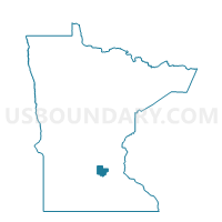
Watertown Voting District, Carver County, Minnesota
About
Outline

Summary
| Unique Area Identifier | 601375 |
| Name | Watertown Voting District |
| County | Carver County |
| State | Minnesota |
| Area (square miles) | 2.64 |
| Land Area (square miles) | 2.59 |
| Water Area (square miles) | 0.04 |
| % of Land Area | 98.31 |
| % of Water Area | 1.69 |
| Latitude of the Internal Point | 44.96021380 |
| Longtitude of the Internal Point | -93.84392070 |
Maps


Graphs
Select a template below for downloading or customizing gragh for Watertown Voting District, Carver County, Minnesota